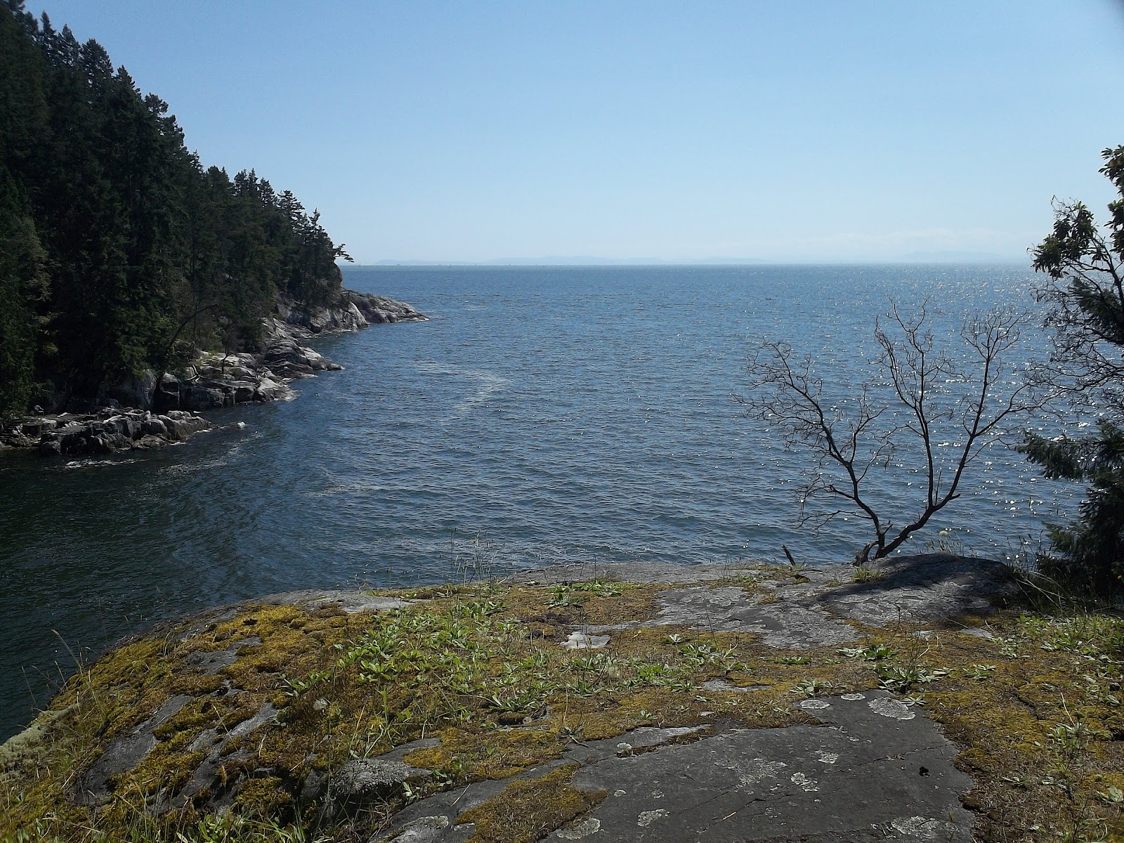
Located at Picadilly North and the train tracks.
The actual developed part of North Picadilly Park really isn't much. It's a 10 meter trail with a bear-proof garbage can.
I was about to leave for the next park after quickly taking that picture when I noticed this:
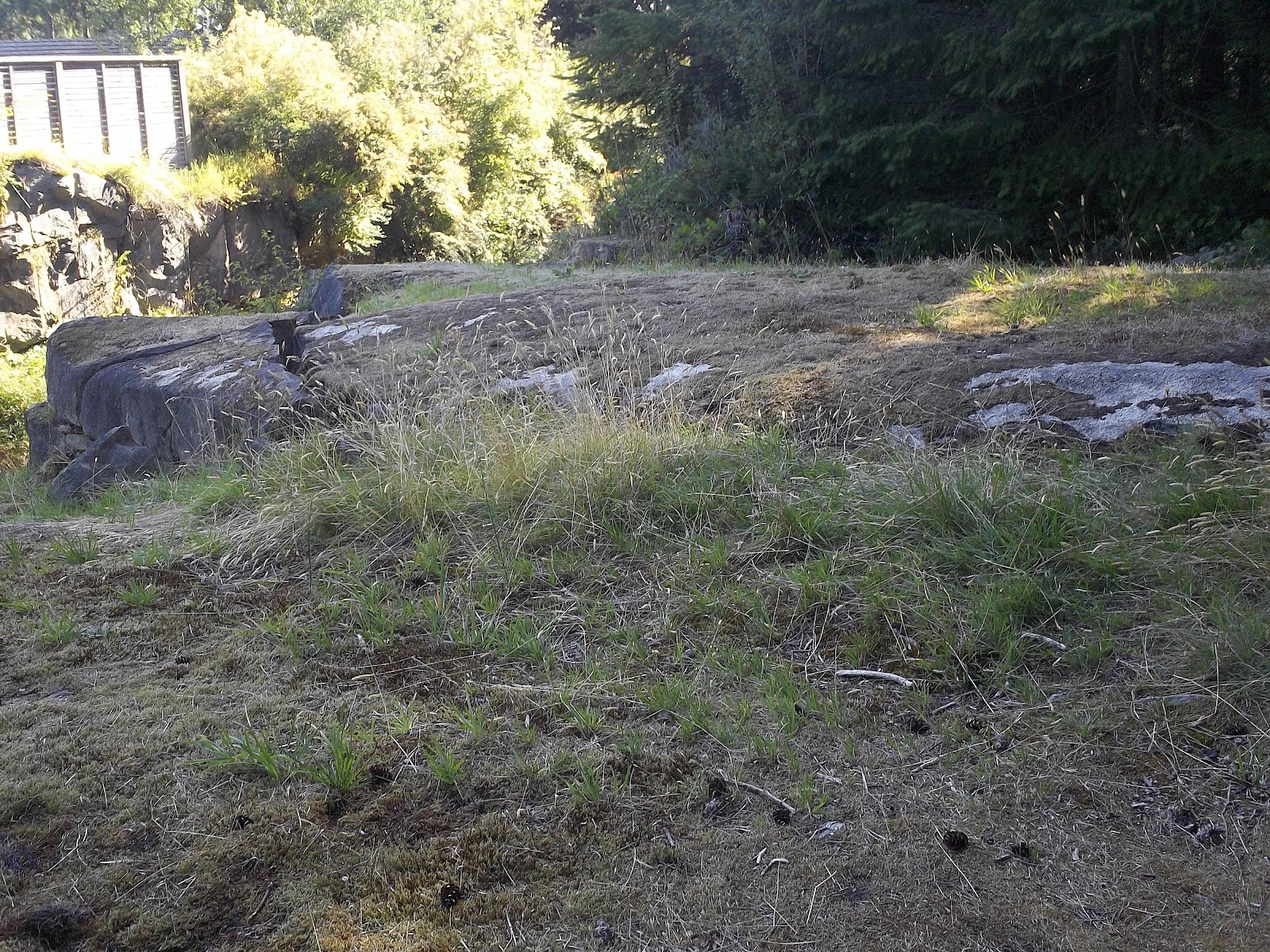
This tiny little bushwhacked trail is easy to miss, but it opens up the rest of North Picadilly Park. It leads to this clearing just above the railroad tracks:
Another trail on the other side of the clearing leads to this forested area:
I've really got hand it to the local kids. They were given a lame park, and they have made the best of it. I'm willing to bet that the little trails were made by them, and they're not grown over. They must be well-used. I can imagine plenty of imaginative play happening here. There's not enough of that happening these days.
PPR
Good: everything good is a result of super cool kids
Bad: there's really not much there at all
4/10
Showing posts with label Caufield. Show all posts
Sunday, 26 August 2012
Caufield Park
On Pilot House Rd.
Caufield Park is a long, narrow strip of land on the waterfront just east of Lighthouse Park. From one end to the other, it varies a lot. Starting with the municipal dock at its western edge.
Set in the charming Caufield Cove, this municipal dock adds the perfect flare of culture to the area. Although it's still in good shape, the dock shows it age with peeling red paint and weathered wood. I plan to come back here in the winter with a friend to take pictures. It's a very photogenic area from up close.
Moving east through Caufield Park, you will next come to a stretch of rocks covered in wild grasses.
As a rule, places with wild grass smell incredible. This place is no exception. I just want to sit there for hours and breathe.
This section of the park also happens to be the least popular for some reason. This doesn't make much sense because there are so many great patches of rock to relax on and it's easy to go swimming from several points in this area. There are a bunch of tiny bushwhacked trails from the road to the waterfront along the way that lead to a bunch of special places to discover. I didn't even have time to explore them all.
Right around the center of the park is an area with grass of a considerably less wild variety.
And yet, for some reason, this area of the park is much more popular. As you can see in the picture, there's actually people in this part. It does make a little bit of sense, though. This area is surrounded by several attractions.
Just behind the bushes in the background of the picture is a huge slab of rock that angles gently down into the ocean. I didn't get a picture of that because it was completely overrun with people on that day. It was just as packed as Ambleside beach gets on a hot day.
There's also this cool old navy anchor hanging off a rock.
It's fun to climb on and a great photo-op. In fact, standing on top of that rock at the time I took the picture was a professional fashion photo shoot team making important sounding phone calls.
Then there's one of my favorite parts of this park:
The old tire swing! I've been visiting this friend every once in a while ever since my Dad introduced us when I was 7 years old. You won't believe how much fun a tire and some rope can be.
In the eastern half of Caufield Park, there's a set of trails through some trees that lead to Pilot cove.
In the picture, you can see some people swimming. On the day I was there, the tide was abnormally high. Usually, there's a beach there made out of almost pure sand. Pilot cove is probably the best place to swim in all of West Vancouver.
Finally, at the eastern tip of Caufield Park, there is a bench. Of course, there are other benches in the park, but this one is by far the best. Why? Just take a look at this view:
PPR
Good: municipal dock, good smelling grass, tire swing, anchor, great swimming beach, good views, washrooms, variety of stuff
Bad: quite popular, washrooms are outhouses
8/10
Caufield Park is a long, narrow strip of land on the waterfront just east of Lighthouse Park. From one end to the other, it varies a lot. Starting with the municipal dock at its western edge.
Set in the charming Caufield Cove, this municipal dock adds the perfect flare of culture to the area. Although it's still in good shape, the dock shows it age with peeling red paint and weathered wood. I plan to come back here in the winter with a friend to take pictures. It's a very photogenic area from up close.
Moving east through Caufield Park, you will next come to a stretch of rocks covered in wild grasses.
As a rule, places with wild grass smell incredible. This place is no exception. I just want to sit there for hours and breathe.
This section of the park also happens to be the least popular for some reason. This doesn't make much sense because there are so many great patches of rock to relax on and it's easy to go swimming from several points in this area. There are a bunch of tiny bushwhacked trails from the road to the waterfront along the way that lead to a bunch of special places to discover. I didn't even have time to explore them all.
Right around the center of the park is an area with grass of a considerably less wild variety.
And yet, for some reason, this area of the park is much more popular. As you can see in the picture, there's actually people in this part. It does make a little bit of sense, though. This area is surrounded by several attractions.
Just behind the bushes in the background of the picture is a huge slab of rock that angles gently down into the ocean. I didn't get a picture of that because it was completely overrun with people on that day. It was just as packed as Ambleside beach gets on a hot day.
There's also this cool old navy anchor hanging off a rock.
It's fun to climb on and a great photo-op. In fact, standing on top of that rock at the time I took the picture was a professional fashion photo shoot team making important sounding phone calls.
Then there's one of my favorite parts of this park:
The old tire swing! I've been visiting this friend every once in a while ever since my Dad introduced us when I was 7 years old. You won't believe how much fun a tire and some rope can be.
In the eastern half of Caufield Park, there's a set of trails through some trees that lead to Pilot cove.
In the picture, you can see some people swimming. On the day I was there, the tide was abnormally high. Usually, there's a beach there made out of almost pure sand. Pilot cove is probably the best place to swim in all of West Vancouver.
Finally, at the eastern tip of Caufield Park, there is a bench. Of course, there are other benches in the park, but this one is by far the best. Why? Just take a look at this view:
PPR
Good: municipal dock, good smelling grass, tire swing, anchor, great swimming beach, good views, washrooms, variety of stuff
Bad: quite popular, washrooms are outhouses
8/10
Monday, 6 August 2012
The Dale Park
Located at Water Ln & The Dale
My favorite part of The Dale Park is just barely inside of it.
It's a hollow stump! I bet it's some kid's fort. I hope I don't have to explain why forts are the best, because I'm not even sure. I just know that everything is more fun when you do it in a fort.
The rest of the park consists of things that are not very easy to get to. You can hear a creek running somewhere inside the bushes, but there's only a few places where you can glimpse it. I didn't even try to get to any of those places. There's one trail running through the park, but it's not an easy one. I found it difficult to get past some parts of it without putting down my waterbottle.
But nevertheless, I followed the trail. At a certain point, I found this nice view through the trees (it's hard to tell in the picture, but one of those trees is an arbutus):
The trail kept going after this point, so I followed it the rest of the way. It ended here:
I wasn't sure what to do there, so I turned around and headed for the next park.
PPR
Good: fort, kinda nice view through trees
Bad: the best view has trees in the way, sketchy trail, most of it is too wild to get to
5/10
My favorite part of The Dale Park is just barely inside of it.
It's a hollow stump! I bet it's some kid's fort. I hope I don't have to explain why forts are the best, because I'm not even sure. I just know that everything is more fun when you do it in a fort.
The rest of the park consists of things that are not very easy to get to. You can hear a creek running somewhere inside the bushes, but there's only a few places where you can glimpse it. I didn't even try to get to any of those places. There's one trail running through the park, but it's not an easy one. I found it difficult to get past some parts of it without putting down my waterbottle.
But nevertheless, I followed the trail. At a certain point, I found this nice view through the trees (it's hard to tell in the picture, but one of those trees is an arbutus):
The trail kept going after this point, so I followed it the rest of the way. It ended here:
I wasn't sure what to do there, so I turned around and headed for the next park.
PPR
Good: fort, kinda nice view through trees
Bad: the best view has trees in the way, sketchy trail, most of it is too wild to get to
5/10
Trails Park
Located adjacent to Lighthouse Park
Originally, I wasn't planning to do Trails Park. It's directly connected to Lighthouse Park, so it hardly seems like it deserves to be considered its own park. However, the official rules of proper park rating state that if there's a bit of green on the map with a name that ends in "Park", it must be visited and rated.
I arrived in the Lighthouse Park parking lot, where the entrance to Trails Park seemed to be located on a sunny Sunday afternoon. It was so busy that there were actually people honking at each other. I found the entrance behind a truck:
It's not very large or marked, so you'll have to look hard to find it. It's not too far from the main entrance to Lighthouse Park and on the left when you're facing that main entrance.
The initial trail up from the parking lot way very steep, but once I was five minutes, in I could barely hear the exceptionally loud parking lot. Despite it being a ridiculously busy day in Lighthouse Park I saw absolutely nobody in Trails Park. If you're looking for a peaceful walk on the perfect afternoon, try Trails Park, because you would never find solitude like this even on a cloudy day in Lighthouse Park.
Although I'm glad I took the time to visit Trails Park, I was right about it not actually being its own park. It has its trails marked with the same signage that exists throughout Lighthouse Park.
I took Deer Fern Trail and I saw deer ferns. Trails Park delivers when it makes promises!
Most of Trails Park looks like this:
I've heard that Lighthouse Park is an old growth forest, but I don't think that Trails Park is. I'm no expert, but that looks like second growth to me. I can tell by how the trees are so much less dense. However, the lack of human traffic now more than makes up for the human disturbance in Trails Park a long time ago.
PPR
Good: quiet, selection of trails (although I only chose one route)
Bad: not an old growth forest, it's hardly its own park, no viewpoints
6/10
Originally, I wasn't planning to do Trails Park. It's directly connected to Lighthouse Park, so it hardly seems like it deserves to be considered its own park. However, the official rules of proper park rating state that if there's a bit of green on the map with a name that ends in "Park", it must be visited and rated.
I arrived in the Lighthouse Park parking lot, where the entrance to Trails Park seemed to be located on a sunny Sunday afternoon. It was so busy that there were actually people honking at each other. I found the entrance behind a truck:
It's not very large or marked, so you'll have to look hard to find it. It's not too far from the main entrance to Lighthouse Park and on the left when you're facing that main entrance.
The initial trail up from the parking lot way very steep, but once I was five minutes, in I could barely hear the exceptionally loud parking lot. Despite it being a ridiculously busy day in Lighthouse Park I saw absolutely nobody in Trails Park. If you're looking for a peaceful walk on the perfect afternoon, try Trails Park, because you would never find solitude like this even on a cloudy day in Lighthouse Park.
Although I'm glad I took the time to visit Trails Park, I was right about it not actually being its own park. It has its trails marked with the same signage that exists throughout Lighthouse Park.
I took Deer Fern Trail and I saw deer ferns. Trails Park delivers when it makes promises!
Most of Trails Park looks like this:
I've heard that Lighthouse Park is an old growth forest, but I don't think that Trails Park is. I'm no expert, but that looks like second growth to me. I can tell by how the trees are so much less dense. However, the lack of human traffic now more than makes up for the human disturbance in Trails Park a long time ago.
PPR
Good: quiet, selection of trails (although I only chose one route)
Bad: not an old growth forest, it's hardly its own park, no viewpoints
6/10
Klootchman Park
Access via Howe Sound Ln.
I did this route on a particularly hot day, so when I reached the shady entrance way to Klootchman Park, so was more than ready to get inside and start exploring.
Klootchman Park is only a 5 minute walk from the incredibly popular Lighthouse Park, and it is also a forested trail park. Because of that, I expected it to be just a smaller version of the same sort of park. But just from a quick look at the ground, I could tell that Klootchman is of far superior quality to Lighthouse.
These roots form a natural staircase along the trail, and they actually still resemble roots. This park is obviously not nearly as overused as Lighthouse. So don't go telling your whole school about this one, but it's definitely worth a visit with a few friends.
Overall, this park is in great shape. It's got what looks like a brand new set of wooden stairs.
This staircase is set against one of the park's vertical rock faces, so it stands out quite a bit. However, in a few years, it'll blend right in. The wood will darken, but the sturdy structure will most likely not be affected at all by then. I bet that after just one winter, these stairs will look like they're meant to be there, just like the rest of the park's infrastructure.
For example, there's these stairs that look almost like naturally placed rocks:
In other news, take a look at that rock face. Now that's cool!
Another feature of Klootchman Park is its excellent huckleberries. Some of the bushes are exceedingly difficult to reach. There's some legit rock climbing required for the best of them, but every berry I saw in the entire park was huge, sweet and juicy.
The biggest problem with the trail through Klootchman Park is that there are very few options about which way to go. All the way down to the water, there is only one path (there's a few small ones as well, but they only lead to backyards). The trail splits off at the end and leads to several different viewpoints, but it would be nice to have a few ways to vary the route there.
That annoyed me the whole way to the cliffs, but once I was at the cliffs... I was standing on a cliff overlooking the ocean and all my troubles floated away.
The cliffs are almost perfectly vertical and plunge several stories down before meeting the ocean. They wrap around the edge of the land and provide almost 180 degrees worth of view. I may have found my new sanctuary for when I need to go somewhere and unwind. My favorite one is this shaded cliff all the way at the far end with a view of East Island.
Not only would it be a great spot to watch a regatta from (by the way, sailboats race here every Wednesday night), but the land is also very nice there. A few of the best huckleberry bushes I mentioned earlier are a simple treacherous climb away, and there's this gorgeous arbutus tree hanging from the rocks just above.
I thought about cliff jumping while I was in Klootchman Park. There didn't appear to be any hazards below, but then I realized that there wouldn't be any way to get back to shore. You could crawl on to East Island, but once you were on that rock, you'd have to hope that a boat willing to pick up hitchhikers would come past soon. Klootchman Park is missing a beach.
The most frustrating thing about this park is that there's such a clear view of the water, but you can't swim in it because there's no safe way in and out. This is the closest thing Klootchman Park has:
It's another pretty spot, but the rock is jagged and the waves could easily smash you against it. Besides, it's a longer swim from the cliffs than I'd be up for.
There's probably better weather to visit Klootchman Park in than sweltering heat. In fact, I'd probably really enjoy this park in the dead of winter. I will probably return to its cliffs to sort out my school season angst some time in November.
PPR
Good: trail in good shape, beautiful landscape, huckleberries, cliffs, peaceful (way fewer tourists than Lighthouse Park)
Bad: lack of trail variety, nowhere to swim, steep hike back out of the park
8/10
I did this route on a particularly hot day, so when I reached the shady entrance way to Klootchman Park, so was more than ready to get inside and start exploring.
Klootchman Park is only a 5 minute walk from the incredibly popular Lighthouse Park, and it is also a forested trail park. Because of that, I expected it to be just a smaller version of the same sort of park. But just from a quick look at the ground, I could tell that Klootchman is of far superior quality to Lighthouse.
These roots form a natural staircase along the trail, and they actually still resemble roots. This park is obviously not nearly as overused as Lighthouse. So don't go telling your whole school about this one, but it's definitely worth a visit with a few friends.
Overall, this park is in great shape. It's got what looks like a brand new set of wooden stairs.
This staircase is set against one of the park's vertical rock faces, so it stands out quite a bit. However, in a few years, it'll blend right in. The wood will darken, but the sturdy structure will most likely not be affected at all by then. I bet that after just one winter, these stairs will look like they're meant to be there, just like the rest of the park's infrastructure.
For example, there's these stairs that look almost like naturally placed rocks:
In other news, take a look at that rock face. Now that's cool!
Another feature of Klootchman Park is its excellent huckleberries. Some of the bushes are exceedingly difficult to reach. There's some legit rock climbing required for the best of them, but every berry I saw in the entire park was huge, sweet and juicy.
The biggest problem with the trail through Klootchman Park is that there are very few options about which way to go. All the way down to the water, there is only one path (there's a few small ones as well, but they only lead to backyards). The trail splits off at the end and leads to several different viewpoints, but it would be nice to have a few ways to vary the route there.
That annoyed me the whole way to the cliffs, but once I was at the cliffs... I was standing on a cliff overlooking the ocean and all my troubles floated away.
The cliffs are almost perfectly vertical and plunge several stories down before meeting the ocean. They wrap around the edge of the land and provide almost 180 degrees worth of view. I may have found my new sanctuary for when I need to go somewhere and unwind. My favorite one is this shaded cliff all the way at the far end with a view of East Island.
Not only would it be a great spot to watch a regatta from (by the way, sailboats race here every Wednesday night), but the land is also very nice there. A few of the best huckleberry bushes I mentioned earlier are a simple treacherous climb away, and there's this gorgeous arbutus tree hanging from the rocks just above.
I thought about cliff jumping while I was in Klootchman Park. There didn't appear to be any hazards below, but then I realized that there wouldn't be any way to get back to shore. You could crawl on to East Island, but once you were on that rock, you'd have to hope that a boat willing to pick up hitchhikers would come past soon. Klootchman Park is missing a beach.
The most frustrating thing about this park is that there's such a clear view of the water, but you can't swim in it because there's no safe way in and out. This is the closest thing Klootchman Park has:
It's another pretty spot, but the rock is jagged and the waves could easily smash you against it. Besides, it's a longer swim from the cliffs than I'd be up for.
There's probably better weather to visit Klootchman Park in than sweltering heat. In fact, I'd probably really enjoy this park in the dead of winter. I will probably return to its cliffs to sort out my school season angst some time in November.
PPR
Good: trail in good shape, beautiful landscape, huckleberries, cliffs, peaceful (way fewer tourists than Lighthouse Park)
Bad: lack of trail variety, nowhere to swim, steep hike back out of the park
8/10
Gulf Beach Park
Access via Marine Dr > Kew Rd > Gulf Pl
Gulf Beach Park appears to be a well-kept local secret. It was only through my expertly honed park spotting skills that I managed to find its entrance:
Beside the private property sign, the blackberry brambles and the slanted construction fence, you can see the telltale sign of cheap but sturdy steps winding their way down to the waterfront.
In addition to it's subtle entrance, you can tell this is a well-loved secret spot because some regular users have actually brought down some deck chairs to supplement Gulf Beach Park's one bench.
I actually like this bench quite a lot. Not just because of it's amazing view and secluded location, but because of it's inscription. I've long been in search of the perfect bench inscription. I don't think I've found it yet, but this one certainly gets an honourable mention. It reads,
Gulf Beach Park appears to be a well-kept local secret. It was only through my expertly honed park spotting skills that I managed to find its entrance:
Beside the private property sign, the blackberry brambles and the slanted construction fence, you can see the telltale sign of cheap but sturdy steps winding their way down to the waterfront.
In addition to it's subtle entrance, you can tell this is a well-loved secret spot because some regular users have actually brought down some deck chairs to supplement Gulf Beach Park's one bench.
I actually like this bench quite a lot. Not just because of it's amazing view and secluded location, but because of it's inscription. I've long been in search of the perfect bench inscription. I don't think I've found it yet, but this one certainly gets an honourable mention. It reads,
Stephen P. Y. Lee
Though we have come to love the mountains,
the sea, this land, we will remember.
Love your family.
I love this one because it's both poetic and original. The praises of the coastal landscape are sung often on north shore benches, but this one managed to say the same thing in a way that's simple, yet special. But most of all, I love it because of the mystery. The 'we will remember' seems to be referring to something specific that Stephen's family understands. I can't help but wonder what that is.
One downside to Gulf Beach Park could be it's size. Besides the area with the bench and chairs in it, there's only the trail there and a narrow slab of concrete resting atop the natural jagged rocks. It's not really the kind of place to run around in. However, I can imagine this place being perfect to have a long conversation at. While looking at Gulf Beach Park's stunning and dynamic view, I could go on for hours with a good friend about anything from the meaning of life to the price of cat food.
Gulf Beach Park is presumably named for its likeness to British Columbia's Gulf Islands. It has a similarly rugged landscape, and it's edge-of-the-earth location makes you feel like you're on an island. The view is just as incredible as some that you can find in the Gulf Islands, and there's just as many boats moving through it. But of course, there are the tightly packed neighbours on either side of this park that are impossible to avoid on the mainland. Although nothing can compare to the actual Gulf Islands, if you can't make it away for the weekend, an hour at Gulf Beach Park should work just fine.
PPR
Good: view, plenty of seating, feels like an island
Bad: small, neighbours, hard to find
6.5/10
Monday, 11 June 2012
Keith Park
The first time I went looking for Keith Park, I didn't find it. I did, however, take this picture:
It was not until after I got myself thoroughly lost in the woods that I realized Keith Park had been right behind me when I took this picture. I felt pretty stupid, but when I returned the next day, I realized why I'd failed to notice the park.
From the road, Keith Park looks like what you see above. That moss at the bottom of the frame is on a concrete border, and beyond that border is a steep drop off. It took a fair amount of creativity and a little bit of climbing to find a way through the thick bushes, but ladies and gentleman, I have been inside Keith Park!
That's a shot of the most friendly part of the park. The ground is unstable throughout the whole place, but at least in this part you can stand up without getting sticks in your hair. It's definitely a beautiful piece of nature, but it's a little too wild to spend any time in. Basically, don't go to Keith Park...
PPR
Good: pretty nature
Bad: it's vacant land, not a park, difficult to reach without trespassing
1/10
If you're looking for an alternative to Keith Park, let me tell you about where I was while lost on the first day I spent looking for the park. Sahalee Trail!
This trail head is on Meadfield Road, near Caufield shopping center, but the picture I took right across the street from Keith Park is another trail head. There's segments of the trail throughout the area, actually. I know there's more of it to find than I've seen. But the part that I did see is very pleasant.
Sahalee Trail has the same sort of nature as Keith Park with a bonus of having the means of seeing it easily. It's hard to believe that you're in the middle of a residential area when walking this trail. That's not to say that this place is completely devoid of civilization. This trail eventually winds up underneath a train bridge.
You can see one of the bridge's supports in the picture. There's also a bridge for the trail here. I love this spot because it captures my imagination. If I had found this place 10 years ago, I would've spent hours playing pretend games here. I still would if I had that kind of time. Obviously it has captured the imaginations of others as well. The bridge supports are covered in graffiti. There are so many talented graffiti artists in the area. It's unfortunate that they are forced into such secluded spots, but at the same time it's always exciting to find a beautiful piece hidden in the trees.
Yes... I am bad at conclusion. Keith Park sucks. Sahalee Trail is pretty.
It was not until after I got myself thoroughly lost in the woods that I realized Keith Park had been right behind me when I took this picture. I felt pretty stupid, but when I returned the next day, I realized why I'd failed to notice the park.
From the road, Keith Park looks like what you see above. That moss at the bottom of the frame is on a concrete border, and beyond that border is a steep drop off. It took a fair amount of creativity and a little bit of climbing to find a way through the thick bushes, but ladies and gentleman, I have been inside Keith Park!
That's a shot of the most friendly part of the park. The ground is unstable throughout the whole place, but at least in this part you can stand up without getting sticks in your hair. It's definitely a beautiful piece of nature, but it's a little too wild to spend any time in. Basically, don't go to Keith Park...
PPR
Good: pretty nature
Bad: it's vacant land, not a park, difficult to reach without trespassing
1/10
If you're looking for an alternative to Keith Park, let me tell you about where I was while lost on the first day I spent looking for the park. Sahalee Trail!
This trail head is on Meadfield Road, near Caufield shopping center, but the picture I took right across the street from Keith Park is another trail head. There's segments of the trail throughout the area, actually. I know there's more of it to find than I've seen. But the part that I did see is very pleasant.
Sahalee Trail has the same sort of nature as Keith Park with a bonus of having the means of seeing it easily. It's hard to believe that you're in the middle of a residential area when walking this trail. That's not to say that this place is completely devoid of civilization. This trail eventually winds up underneath a train bridge.
You can see one of the bridge's supports in the picture. There's also a bridge for the trail here. I love this spot because it captures my imagination. If I had found this place 10 years ago, I would've spent hours playing pretend games here. I still would if I had that kind of time. Obviously it has captured the imaginations of others as well. The bridge supports are covered in graffiti. There are so many talented graffiti artists in the area. It's unfortunate that they are forced into such secluded spots, but at the same time it's always exciting to find a beautiful piece hidden in the trees.
Yes... I am bad at conclusion. Keith Park sucks. Sahalee Trail is pretty.
Saturday, 9 June 2012
Plateau Park
Plateau Park is a simple one. It's a grassy field and a playground in the middle of a residential area.
This park is great because it fits the neighborhood. In the nearby area there is a strip mall with a grocery store, a high school and an elementary school. This makes it the perfect place for families with kids of all ages to live. Plateau Park is the perfect place for the whole family to spend time. While the little kids play on the playground, parents can sit at the picnic tables or on the field to watch their children from a safe distance. Meanwhile, the older siblings can hang out on this concrete water thing:
It's a great place to chat and not be seen by adults without going too far away. When I was at Rockridge, there was a group of students who loved to spend their spare blocks sitting here on sunny days.
And here's something for the kids who were never satisfied with playground equipment (because I know I was one of them)
There are plenty of weird shaped trees around the edges of Plateau Park. Go nuts, kids!
There's also a tennis court here. I actually saw people playing tennis on it. That's a first. There are tennis courts everywhere, but hardly ever tennis players. Why are there so many tennis courts?
PPR
Good: fun for the whole family, playground, field, weird trees, tennis court, good location
Bad: nothing too special here, there are better playgrounds (try John Lawson Park)
6.5/10
This park is great because it fits the neighborhood. In the nearby area there is a strip mall with a grocery store, a high school and an elementary school. This makes it the perfect place for families with kids of all ages to live. Plateau Park is the perfect place for the whole family to spend time. While the little kids play on the playground, parents can sit at the picnic tables or on the field to watch their children from a safe distance. Meanwhile, the older siblings can hang out on this concrete water thing:
It's a great place to chat and not be seen by adults without going too far away. When I was at Rockridge, there was a group of students who loved to spend their spare blocks sitting here on sunny days.
And here's something for the kids who were never satisfied with playground equipment (because I know I was one of them)
There are plenty of weird shaped trees around the edges of Plateau Park. Go nuts, kids!
There's also a tennis court here. I actually saw people playing tennis on it. That's a first. There are tennis courts everywhere, but hardly ever tennis players. Why are there so many tennis courts?
PPR
Good: fun for the whole family, playground, field, weird trees, tennis court, good location
Bad: nothing too special here, there are better playgrounds (try John Lawson Park)
6.5/10
West Vista Park
Located on West Vista Ct.
If you like views even a little bit, West Vista Park's name alone is enough to make you want to visit it. However, I had another reason for wanting to visit. Back in grade 12, when I went to Rockridge, I would sneak into an empty lot that was right around the place where this park was marked on the map. It had an incredible view, and I thought that empty space may have since been turned into a park. But unfortunately that was not the case...
It turns out that West Vista Park had always been right next to that lot, but I had never noticed it was there. That's probably because it looks like this:
A bench, a tree, some cobblestones, some ferns, a garbage can, and a trail head. It's not too interesting... aside from the trail head. I recommend following this trail, at least for a little while. Here's what it looks like about 30 seconds in:
A staircase with a background like that?! Who could resist? I figured that it must lead to an amazing viewpoint.
It did! This would be the best place to watch a regatta from. I intend to return to see one as soon as possible. Also, can I just point out how lucky the people in that house are? I hope they know how lucky they are. They can sit and look at this view. The one thing this spot is missing is a bench.
This viewpoint was actually just at the bottom of those stairs. The trail continues after that, but it continues on a steep downward slope.
The view doesn't get any better, but I still wanted to see where the trail led. I got down quite a ways before I realized it was probably just going to Marine Drive and I still had two parks left to find in the opposite direction. So I begrudgingly hiked back up the hill, but once I got home and checked the full map, I saw that the trail led to what doesn't seem like anywhere. Now I want to go back and see where it goes! Maybe I'll check it out after the regatta.
PPR
Good: view, well maintained trail (with safety railings and grip)
Bad: lame main section, very steep trail, misplaced bench
5.5/10
If you like views even a little bit, West Vista Park's name alone is enough to make you want to visit it. However, I had another reason for wanting to visit. Back in grade 12, when I went to Rockridge, I would sneak into an empty lot that was right around the place where this park was marked on the map. It had an incredible view, and I thought that empty space may have since been turned into a park. But unfortunately that was not the case...
It turns out that West Vista Park had always been right next to that lot, but I had never noticed it was there. That's probably because it looks like this:
A bench, a tree, some cobblestones, some ferns, a garbage can, and a trail head. It's not too interesting... aside from the trail head. I recommend following this trail, at least for a little while. Here's what it looks like about 30 seconds in:
A staircase with a background like that?! Who could resist? I figured that it must lead to an amazing viewpoint.
It did! This would be the best place to watch a regatta from. I intend to return to see one as soon as possible. Also, can I just point out how lucky the people in that house are? I hope they know how lucky they are. They can sit and look at this view. The one thing this spot is missing is a bench.
This viewpoint was actually just at the bottom of those stairs. The trail continues after that, but it continues on a steep downward slope.
The view doesn't get any better, but I still wanted to see where the trail led. I got down quite a ways before I realized it was probably just going to Marine Drive and I still had two parks left to find in the opposite direction. So I begrudgingly hiked back up the hill, but once I got home and checked the full map, I saw that the trail led to what doesn't seem like anywhere. Now I want to go back and see where it goes! Maybe I'll check it out after the regatta.
PPR
Good: view, well maintained trail (with safety railings and grip)
Bad: lame main section, very steep trail, misplaced bench
5.5/10
Location:
West Vista Park
Thursday, 17 May 2012
Parthenon Park
Access via Marine Dr > Parthenon Pl.
Oh, Parthenon Park... The entrance to this park is similar to that of Kew Beach Park. You will need to walk past the DO NOT ENTER sign. Notice the tiny sign to the left that reads "BEACH".
After passing a number of equally aggressive 'okay, you can walk through here, but use the trail and we still won't like it' signs, you will have to go down this crazy set of stairs:
But when you get around the corner, all feelings of hesitance will evaporate as you see this for the first time:
There's picnic benches, what appear to be wishing wells, trails leading to the waterfront, and goslings.
There's even a statue! A huge statue!
But when you get to the bottom of the stairs, you will see this:
You might feel like crying at this point. This is the actual Parthenon Park:
It's got a nice view, but it's not exactly a beach. It's a raised slab of concrete. Yet, somehow, we still managed to enjoy it. It wasn't even hard to do. We just sat with our feet over the edge and tried to figure out what island we were looking at (after consulting a map once I got home, I've concluded that it's a part of the mainland called Irwin Bluff). There were also delicious que pasa corn chips involved. They just have the perfect crunch.
You can also swim at Parthenon Park. The ground at the bottom of the concrete is sandy, and although the bottom of the ladder is encrusted in muscles and barnacles, it hasn't rusted out yet. As long as you're wearing good water shoes, you'll survive it. We recommend checking out the brand Vibram and their line of 'five fingers' shoes (this post sure is brand-heavy. Nina, let's find ourselves some sponsors).
But as we hiked back up the crazy staircase and looked at the private property, disappointment won. Pathenon Park, you dirty tease!
PPR
Good: nice view, sand
Bad: epic disappointment private property, concrete, long & steep walk out
3.5/10
Location:
Parthenon Park
Subscribe to:
Posts (Atom)